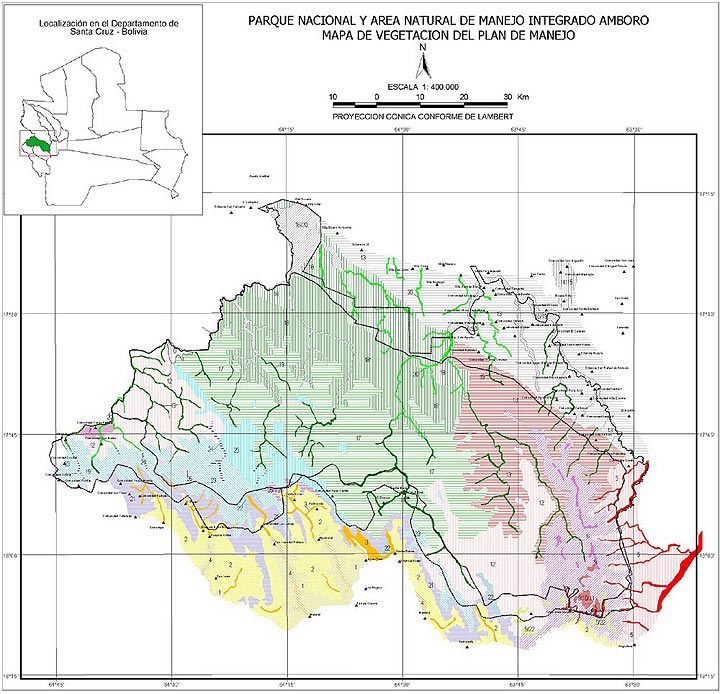
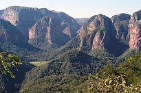
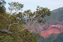
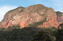
In 1996, Gonzalo Navarro, Israel Vargas, et al. published a very detailed vegetation map and classification which is adapted here. Their map was based on extensive field work as well as interpretation of satellite images. The front ranges of the Andes in this area consist of a series of sandstones and shales, producing a majestic landscape of cliffs in the deeply incised river valleys. Some of the massive red sandstones form huge rounded “haystacks” such as the “Volcanes” near Bermejo and most famously the “Fuerte” near Samaipata with its important archeological features.
Map Legend (click on the image thumbnails to enlarge them):
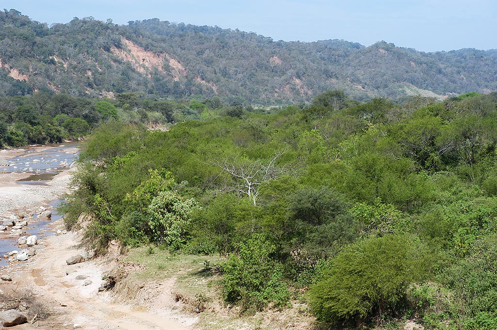
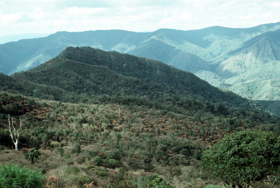
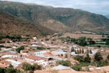
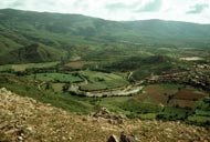
Vegetation types 1 through 4 represent the dry vegetation of the so-called mesothermic interandean valleys. The “old highway” from Santa Cruz to Cochabamba follows these valleys, where road construction is simple and where the towns of the region are located near productive agricultural land based on the summer rains or on irrigation. 1 Bosque semiárido chaqueño-interandino/Semi-arid interandean chaco woodland.
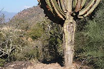
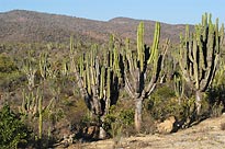
The vegetation of the valley floors could be called “woodland with cacti”. It is especially well-developed between Los Negros and Comarapa, especially near Pampa Grande, Mataral and San Isidro. The majority of the species flower at the beginning of the rains in December. The woodland was originally dominated by soto, Schinopsis haenkeana and Loxopterygium grisebachii, both of the Anacardiaceae. The shrubs are often spiny and include Koeberlinia spinosa (disjunct from the deserts of the southwestern United States and northern Mexico), the bizarre leafless “tree” composed entirely of stiff, spiny branches called lanza-lanza (Prosopis kuntzei), and cacti such as the giant caraparí (Neoraimondia herzogiana), several species of Opuntia, Pereskia diaz-romeroana and P. sacharosa. Capparaceae such as Capparis atamisquea and C. speciosa are common.
  2 Bosque seco chaqueño-interandino/Dry interandean chaco woodland.
An equally dry forest occupies the slopes, but with less representation of Cactaceae. The forest is low, subjected to extensive cattle grazing, sand doinated by soto, Schinopsis haenkeana, quina-quina (Myroxylon peruiferum), Pisonia ambigua, ahuaí, Chrysophyllum gonocarpum), Aralia soratensis, Stillingia peruviana and Pisonia ambigua.
   3 Bosque ribereño chaqueño-interandino/Riverine interandean chaco woodland.
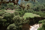
Due to the presence of a higher water table, this is a taller woodland with ceibo (Erythrina falcata), Jacaranda mimosifolia, Salix humboldtiana. 4 Bosque freatófilo chaqueño-interandino/Phreatic interandean chaco woodland.
Where there is a subterannean source of water, the vegetation includes Prosopis alba, P. flexuosa, and Vallesia glabra.
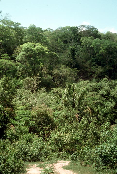
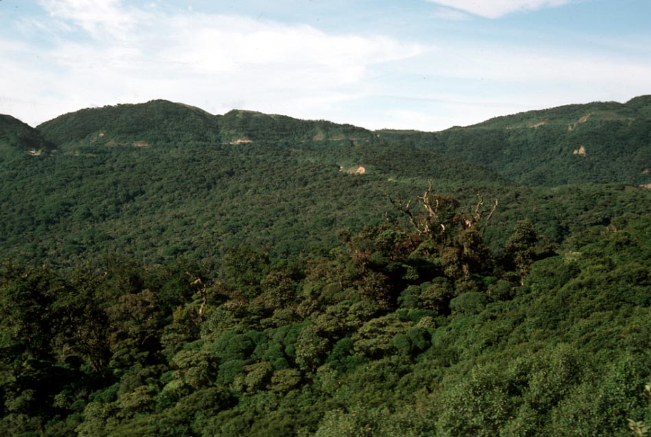
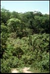
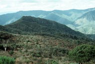
5 Bosque subhúmedo deciduo del sureste de Amboró/Subhumid deciduous forest of southeastern Amboró.
This is forest is almost completely deciduous during the dry season. It covers the hills at less than 900 meters above sea level in the extreme southeast of the Flora region. Part of this vegetation type covers the non-consolidated sediments forming low hills east of the true andean foothills. Among the dominants are curupaú (Anadenanthera macrocarpa), cuchi (Astronium urundeuva), tajibillo (Cybistax antisiphylitica), Eriotheca roseorum and jopo de mono (Zeyheria tuberculosa).
   6 Bosque subhúmedo-húmedo semideciduo del sureste de Amboró (termotropical superior)/Subhumid to humid deciduous forest of southeastern Amboró.
Between 900 and 1100 meters above sea level the conditions are somewhat cooler and wetter and the forest is only partially deciduous during the dry season. Among the dominants are jichituriqui (Aspidosperma cylindrocarpum), mechero (Cariniana estrellensis), cedro (Cedrela lilloi), ajo (Gallesia integrifolia), Pachystroma longifolium, Pogonopus tubulosus and tajibo amarillo (Tabebuia lapacho).
 7 Bosque subhúmedo semideciduo de valle interno yungueño/Subhumid semi-deciduous forest of the internal Yungas valleys.
In the extreme western Amboró Park area is the region of San Mateo, where a semi-deciduous forest is found in the interior valleys. It is very much endangered by agriculture. Trees include jopo de mono (Zeyheria tuberculata), cedro (Cedrela fissilis), Luehea tomentella and Picramnia sellowii. 8 Bosques ribereño del sureste del Amboró/Riverine forest of southeastern Amboró.
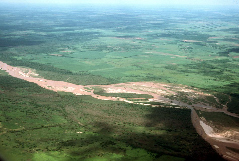
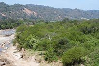
From the Río Colorado to the Río Piraí are a series of east-flowing rivers emerging from the Andean foothills. The frequent violent floods produce a disturbed sandy zone dominated by Acacia aroma, A. albocorticata, Tessaria integrifolia, and Baccharis salicifolia. In the more stable vegetation along the smaller creeks are found Vitex pseudolea, Licaria triandra and Sapindus saponaria.
9 Bosque bajo de filos pedregosos/Low forest on rocky ridgetops.
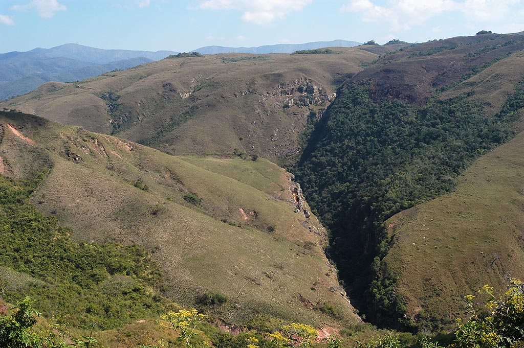
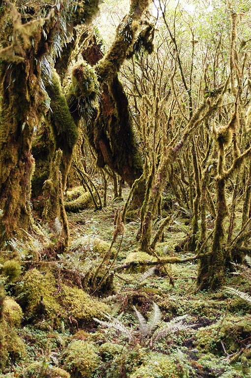
On ridges between 1100 and 1200 meters above sea level, and from Cerro Amboró itself to “Los Volcanes” near Bermejo there develops a low woodland characterized by aliso (Alnus acuminata), Clethra scabra, Escallonia paniculata, various species of Myrtaceae, Ternstroemia, Viburnum and Myrsine. The shrublands are dominated by Melastomataceae, Ericaceae, Clusia, Compositae and Dodonaea viscosa.
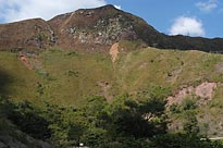
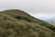
  10 Praderas saxícolas y/o antropogénicas/Rocky and/or anthropogenic grasslands.
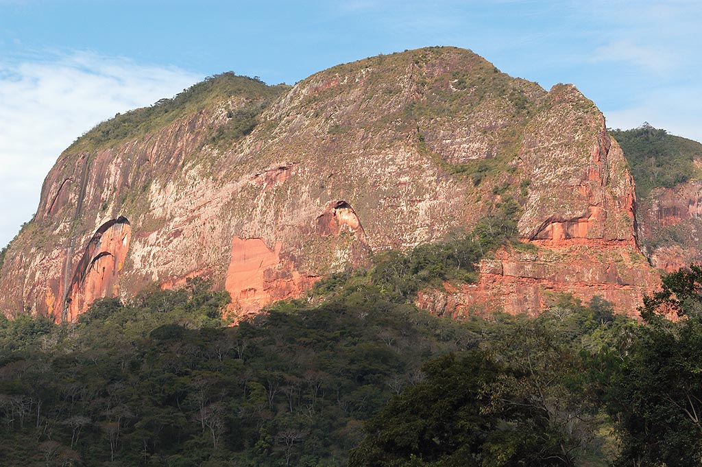
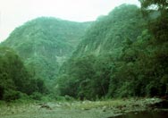
Grasslands dominate the summits of the massive red sandstone mountains of “Los Volcanes”. This vegetation is partly natural but becomes more extensive by degradation of surrounding woodlands by fires and grazing, as can be seen in some of the landscapes between Bermejo and Samaipata.
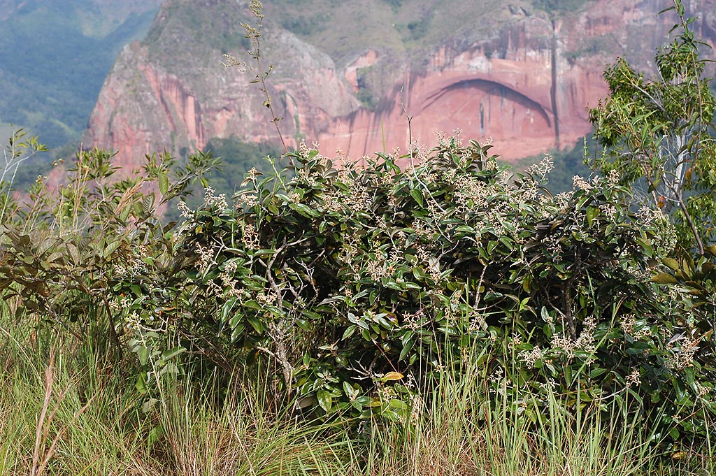
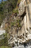
 11 Vegetación saxícola y rupestre/Rock and cliff vegetation.
The upper Carboniferous Escarpment formation and the upper Cretaceous Cajones formations dominate the landscapes of “Los Volcanes”, Bermejo and “El Fuerte” de Samaipata. These are massive reddish sandstones which form enormous rounded hills with vertical cliffs colonized by a specialized flora including the massive Tillandsia samaipatensis with the bright yellow hanging inflorescences as tall as a person.
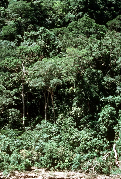
  12 Selva yungueña húmeda pluviestacional (termotropical superior)/Humid seasonal yungas forest.
In the southeastern parts of the Flora area, between 1100 and 1900 meters above sea level, is an endangered humid forest type, with various highly prized lumber species. Imporant tree species include Ceiba boliviana, cedro (Cedrela lilloi), ahuaí (Chrysophyllum gonocarpum), nogal (Juglans boliviana), various species of Lauraceae (Nectandra, Ocotea) and tajibo amarillo (Tabebuia lapacho).
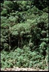
 13 Selva amazónica húmeda pluviestacional (termotropical inferior)/Seasonal humid Amazon rain forest.
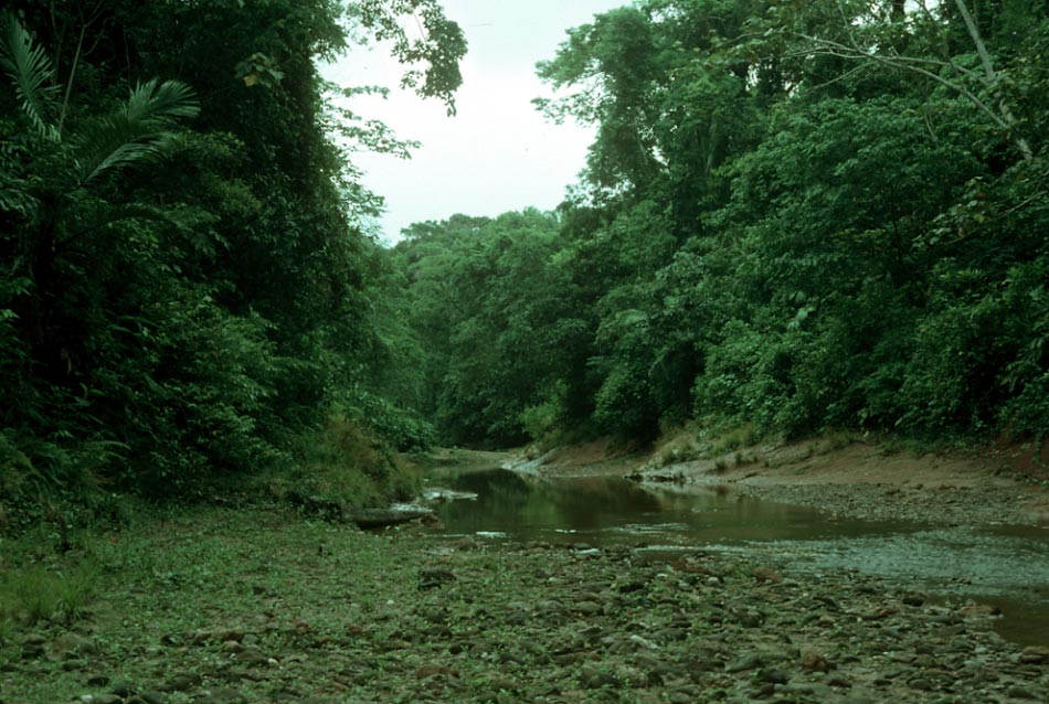
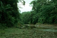
This is the “rain forest” or “jungle” below 1100 meters above sea level, here reaching its southernmost point in western South America, where it hugs the base of the Andean foothills to a little further south than Buena Vista, where it begins to pass into the semi-deciduous forests to the south. The forest is characterized by a large number of species which reach their southern limit of distribution in this vegetation type, including many palms such as the chonta (Astrocaryum chonta), Iriartea deltoidea, Jessenia bataua, Euterpe precatoria, tembe (Bactris gasipaes), Socratea exorrhiza, as well as the jipijapa (Carludovica palmata) and trees such as mara (Swietenia macrophylla), Centrolobium ochroxylum, Terminalia amazonia, Poulsenia armata, Ruizodendron ovale, Talauma boliviana, and many more.
  14 Bosque bajo semi-esclerófilo brasileño-paranense /Low semi-sclerophyllous Brazilian/Paraná woodland (cerradão).
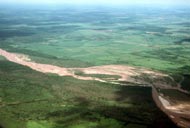
A highly interesting vegetation type has been more or less excluded from of this Flora project. Between Santa Cruz and Buena Vista there is a strip of the low forest or woodland with interspersed savannas on rolling, deeply leached soils. Many of the species are those of the vast “cerrado” region of central Brazil which extends across the border into Bolivia on the Precambrian shield but stops abruptly at the alluvial plain between the shield and the Andean foothills. It can be seen very well along the highway between Buena Vista and Portachuelo, but is only barely represented in a few patches around Buena Vista in the official Flora area. Some representative species are Curatella americana, Dipteryx alata, Terminalia argentea and Vochysia mapiriensis. A few of these species can also be found on the sandstone mountains near Bermejo. 15 Bosque bajo estacionalmente anegado, brasileño-paranense. This is the seasonally flooded phase of the previous vegetation. 16 Selva inundada estacionalmente por aguas blancas (várzea)/Seasonally inundated forest along white water rivers.
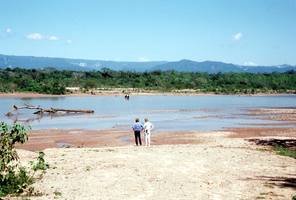
Along the major rivers such as the Surutú and Yapacaní in the rain-forest zone is a seasonally inundated forest called “várzea”. It has generally been much disturbed by slash-and-burn agriculture. It is characterized by ochoó (Hura crepitans), perea (Ochroma pyramidale), Poulsenia armata, Virola flexuosa and V. sebifera.
17 Selva yungueña húmeda pluvial (termotropical superior)/Humid pluvial yungas forest.
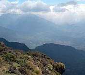
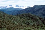
The most humid and the least-explored part of the Park are the slopes between 1100 and 1900 meters above sea level that receive the humid winds from the Amazon basin. The forest is characterized by Dictyocaryum lamarckianum and species of Ficus. Epiphytes are abundant. It is one of the most important zones in the Park for conservation purposes even before the exact floristic composition is known.
 18 Selva amazónica húmeda pluvial (termotropical inferior)/Humid pluvial Amazon rain forest.
The most humid lowland evergreen forest is found below 1100 meters above sealevel in the northwestern part of the Park. It is dominanted by Eschweilera coriacea, Jessenia bataua, Iriartea deltoidea, Sloanea fragrans and Bolivia’s only representative of the Magnoliaceae, Talauma boliviana. This is the vegetation type most menaced by slash-and-burn agriculture. 19 Bosque ripario yungueño termotropical superior y comunidades ribereñas pioneras/Riparian yungas forest and pioneer riverbank communities.
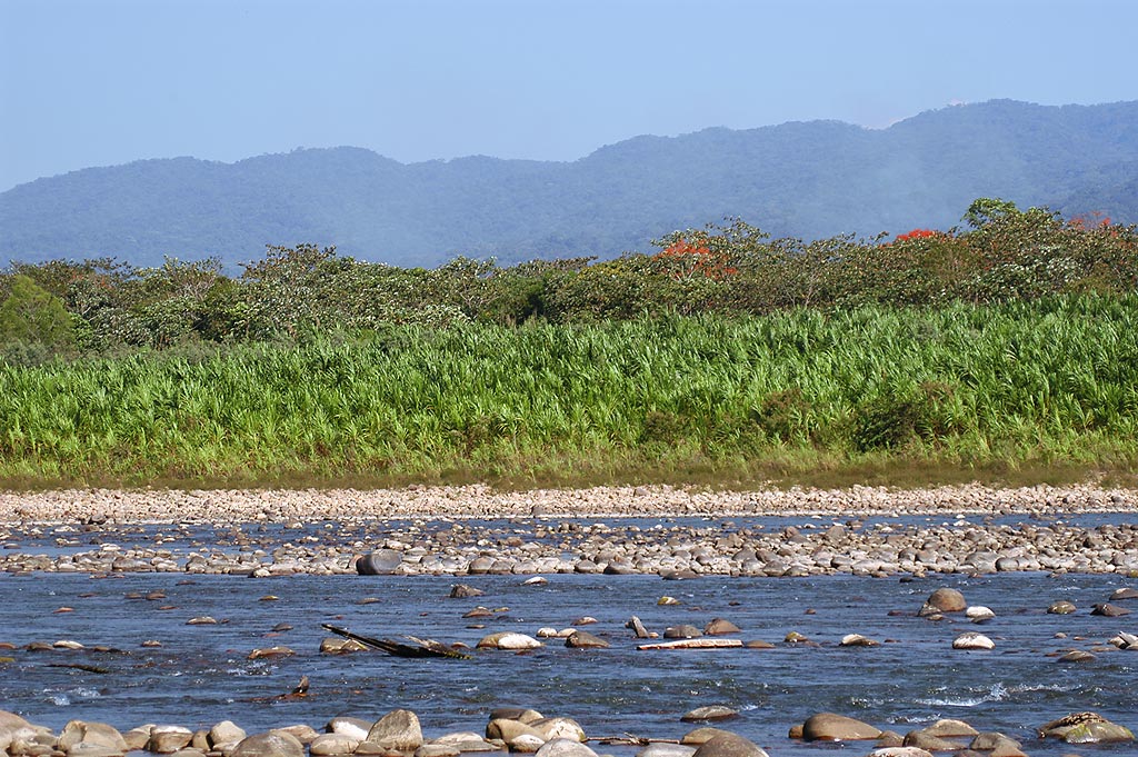
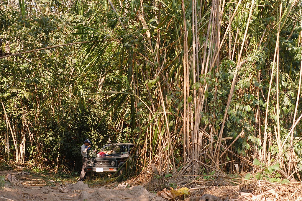
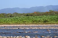
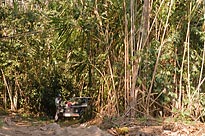
Along the Surutú, Saguayo and other rivers the riparian and pioneer vegetation is dominated by chuchío (Gynerium sagittatum) and parajobobo (Tessaria integrifolia) and sometimes the giant bamboo tacuarembó (Guadua chacoensis) and sauce (Salix humboldtiana). There is constant natural disturbance of erosion in some places and deposition of sand in others, especially during floods, and the vegetation is a complex of various phases of re-establishment. 20 Bosque ripario termotropical inferior y comunidades ribereñas pioneras/Riparian rainforest forst and pioneer riverbank communities.
A pioneer vegetation similar to the preceding is found along the rivers from the Yapacaní to the Ichilo, also dominated by chuchío and parajobobo, but with the addition of species such as Bellucia aequiloba and Croton matourensis, with a more strictly Amazonian distribution.
21 Bosque andino subhúmedo semideciduo (tucumano-boliviano)/Subhumid semideciduous Andean forest (Tucumán-Bolivian forest).
This humid forest is found between 1900 and 2200 meters above sea level, and forms a zone between the dry interandean valleys and the more humid upper altitude forests (22 and 23). In the Flora area, this vegetation has been much disturbed; it is characterized by Berberis bumeliifolia, Condalia weberbaueri, Erythrina falcata, Escallonia millegrana, Kageneckia lanceolata, Mauria thaumatophylla, Schinus myrtifolius and Tipuana tipu. With clearance and pasturing, it often is converted into shrublands of Baccharis dracunculifolia, B. genistelloides and Dodonaea viscosa. 22 Bosque andino húmedo de mirtáceas (tucumano-boliviano)/Humid Andean forest of Myrtaceae.
Between 2100 and 2400 meters above sea level is an Andean forest dominated by Myrtaceae, especially the sahuinto, Myrcianthes callicoma and M. pseudomato. Also found here are Blepharocalyx salicifiolius, Cedrela lilloi, Ceroxylon, Clethra scabra and Viburnum.
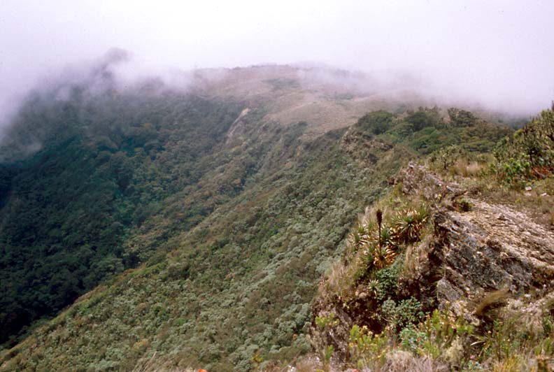
 23 Pinar yungueño pluviestacional húmedo/Seasonal pluvial yungas Podocarp forest
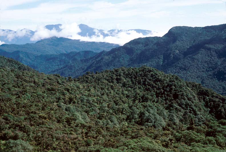
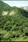
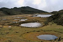
This montane forest is commonly called the “cloud forest” as it is enveloped in the clouds for at least part of the day for most days of the year. It is easily seen along the “old highway” between Comarapa and the valley of Pojo across the border in the Department of Cochabamba. There are also more or less transitable gravel roads which ascend into these forests from Mairana, San Juan del Potrero and Comarapa. The forest is short and dominated by Blepharocalyx salicifolius and the timber species of gymnosperms, Prumnopitys exigua, Podocarpus parlatorei and P. rusbyi. In places there are veritable forests of the tree ferns Alsophila incana and Dicksonia sellowiana. The genus Weinmannia is also well represented. A few of the higher ridgetops are open, humid tussock grasslands.
    24 Bosque ripario yungueño mesotropical/Riparian yungas subtropical forest.
The riverine forests between 1900 and 3100 meters are dominated by Alnus acuminata and Vallea stipularis. 25 Pinar yungueño pluvial, húmedo-hiperhúmedo/Pluvial yungas Podocarp forest, humid to hyperhumid.
On the N- and NE-facing slopes of the upper reaches of the Río Ichilo-San Mateo there is a forest of Podocarpus rusbyi, Weinmannia cf. fagarioides, Gaiodendron punctatum and Brunellia rhoides, and epiphytes are abundant and diverse.
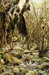
26 Bosque yungueño hiperhúmedo de ceja de monte/Hyperhumid yungas forest on cloud forest ridges
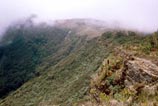
The extreme phase of the cloud forest is found between 3000 and 3100 meters above sea level in the highest parts of the Park, to the northeast of Comarapa. It is a low, dense forest or woodland with Escallonia myrtilloides, Gaultheria glomerata, G. vaccinioides, Hesperomeles lanuginosa, Pernettya prostrata, and Weinmannia microphylla. It is the only part of the Flora area where the Ericaceae play an important role in the vegetation.
|