The Serra Grande Forest
This privately owned forest of ca. 300 ha is 7.3 km north of the town
of Serra Grande, Munícipio of Uruçuca, Bahia, Brazil (14°25'S,
39°01'W), approximately 3 km from the coast, and has an elevation of
75-150 m. The study site (now the Fazenda Catitú) is at the southern end of the newly formed
Serra do Condurú State Park.
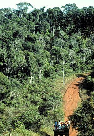
Serra do Condurú State Park
The Park was established by the state of Bahia in 1996 because of a
convergence of three factors:
- a growing local awareness of the need to conserve more natural areas (stimulated by a local NGO, IESB),
- the planning of 80 km of paved road to parallel the coast between Ilhéus and Itacaré, and
- our research in the area, which provided hard data on the levels of diversity, percentage of endemism, and numbers of new species discovered in the area.
The park and its boundaries have been established and the state is in the process of acquiring the forested land from private landholders. The area of the park is ca. 11,000 ha, is ca 30 km long, and averages 3-4 km wide. It lies about 50 km north of Ilhéus to ca. 5 km south of Itacaré and has an elevation of ca. 50-250 m.The annual rainfall in the park probably averages slightly less than
2000 mm per year; the two nearest measuring stations are Ilhéus
(40 km S of Serra Grande with 1948 mm/year) and Uruçuca (30 km WSW
of Serra Grande with 1832 mm/year; Rocha Filho 1976). While there
is no distinct, predictable dry season in this part of Bahia, rainless
periods of 1-3 months occasionally occur, usually from December to March
(Rocha Filho 1976; Mori et al. 1983). The soil is a laterite locally
classified as the variety "Colônia concrecionário" (Melo 1985)
equivalent to a typic gibbsiorthox (United States Soil Conservation Service
1975). According to Melo (1985), it is strongly acidic, has a high percentage
of gravel-sized aggregates that inhibit water retention and root penetration,
and is considered to have poor agricultural potential.