From the Field: Bill Buck in Cape Horn 2013, Day 13
Posted in Bill Buck, From the Field, Science on March 7 2013, by William R. Buck
January 22, 2013, Prov. Antártica Chilena, Comuna Cabo de Hornos, Isla Navarino, Puerto Williams, 54°56’S, 67°37’W
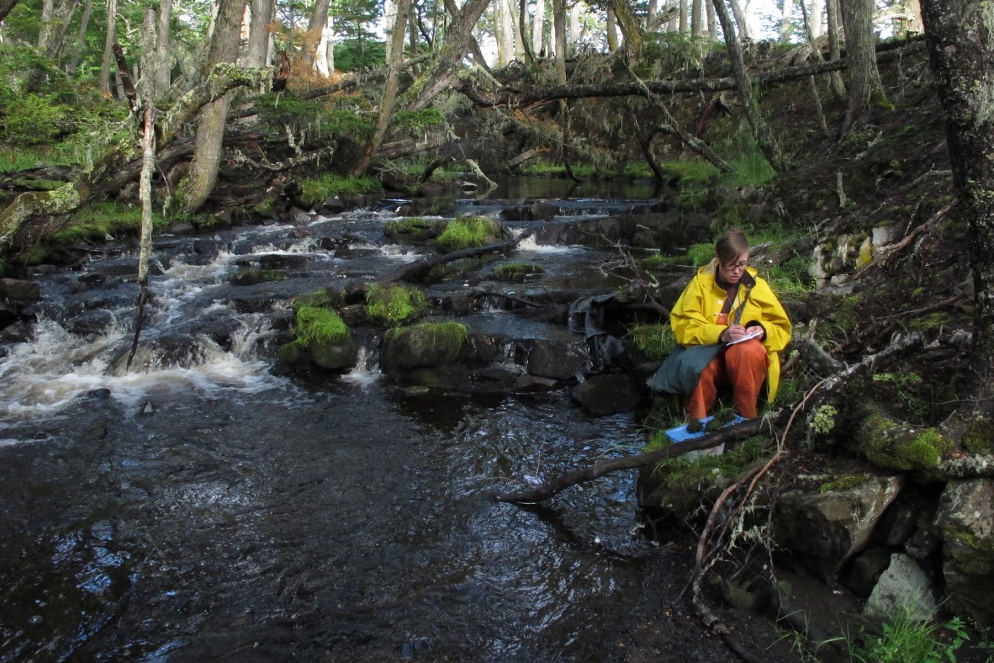
This is our last day on the north shore of Isla Navarino. The weather forecast bodes well for an ascent of Pico de la Bandera. As predicted, we get a slow start to the morning. Blanka and Laura are driven out to Puente La Cascada to see if they can find more interesting hepatics where they found the Lethocolea. Ernesto then heads to his 8:30 appointment with the naval commander to see about getting us permission to access the three islands east of Navarino; Pictón, Nueva, and Lennox islands. He then returns to pick up Blanka and Laura who have indeed found several additional interesting liverworts. Next, a stop to retrieve some laundry, then a stop to pick up lunches from a local store, and then finally we reach the trailhead for the ascent of Pico de la Bandera around 11:30 a.m.
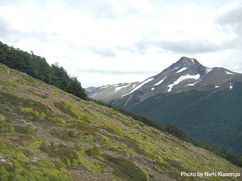
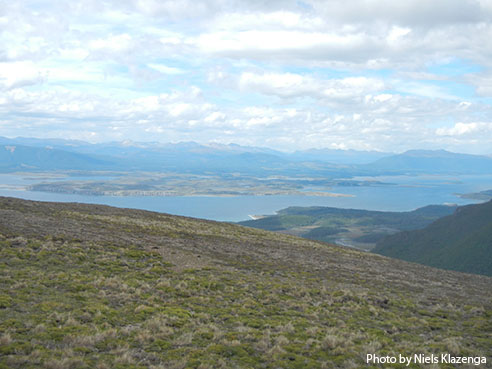
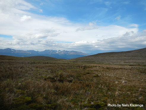
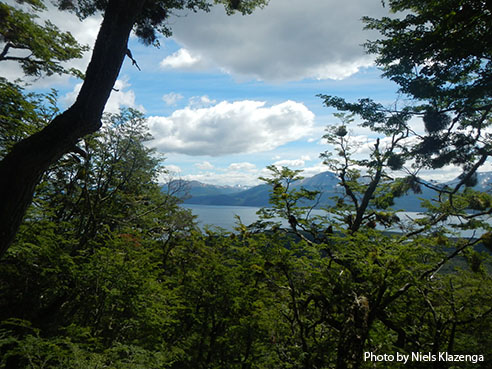 The hike to the top isn’t terribly long, only about 1.2 miles with an elevation of 1,500 feet. Nevertheless, I doubt that I will make it to the summit. Ever since a field trip to the mountains of North Carolina in October, 2012, my hips have bothered me on successive uphill hikes and stairs. However, they have been fine on this trip so far, and I think I might make it. So, we all start up the trail, though I soon decide that since I have been to the summit twice before, I will just poke along the trail and see what I can find to collect without duplicating my efforts of previous years. The trail isn’t steep and I make my way to the 400 meter marker. I look at my watch and realize this has taken me four hours! This is when I decide it best not to continue making my ascent and turn aside to collect in an open Nothofagus pumilio (southern beech) forest before starting my descent.
 In very short order I hear Ernesto’s voice behind me on the trail. I turn around and find him with a couple from Canada and New Zealand who I had met on the trail earlier. The couple are putting together a sailing ship for scientific expeditions. I explain our needs to them in terms of dryer and microscope space, but they seem to be envisioning a smaller ship. They invite us tonight to stop by and see their ship, and I in turn invite them to come visit the Don José Miguel. We leave them at a rest area and continue down the trail. Both Juan and Ernesto say my Spanish is improving, but I’m not sure they’re not just becoming more used to how I mangle their language. That said, Ernesto and I do manage to carry on a continuous conversation in Spanish during the one-hour descent, so maybe it is improving, though I am not overly convinced.
 Ernesto has another meeting with the navy at 6 p.m. and needs the permit we were given to collect plant specimens in national parks, even though Pictón, Nueva, and Lennox islands are not part of a park. Arriving back at the field station early I retrieve our collecting permit while Ernesto prepares for his appointment with the military. I am able to get all my day’s collections numbered, a shower and a shave, and the beginning of today’s blog done before the others return. I was able to spend the majority of today alone which leaves me in a charitable mood. Although there are times when I enjoy the company of others, I am most happy when I am completely alone–including without electronic devices. This is as true in the field as it is back home. Today I was on a well-marked trail and able to poke along at my own pace, peering through my hand lens at whatever caught my attention, and it was close to paradise. But even a bad day in the field is better than a good day in the office. Now that I am finished with my work for the day I am considering going over to see that sailboat this evening since I have no work awaiting me after dinner.
 After another lovely dinner at our restaurant we need to settle a complicated bill for our three dinners, including a separate bill for alcoholic beverages (NSF does not pay for alcohol). As we are attempting to settle up the restaurant says they prefer to be paid in dollars, so I return to the ship to get my wallet and finally pay the bill about an hour later! I head for bed (the sailboat will have to wait), but Juan and Ernesto are not so fortunate, though for good reason! At around 3 a.m. they receive our permissions to collect on Pictón, Nueva, and Lennox islands from the navy! Juan is quick to note that if Ernesto had not been involved in the negotiations, we probably would never have been allowed to collect on these sensitive islands. Ernesto is very skilled in negotiations and apparently called on all of his skills in order to pull this off! I am still not clear as to what we can and cannot do on the islands, but that can wait until tomorrow.
 We will leave fairly early and have breakfast on the ship as we head toward the west coast of Navarino and Puerto Inútil (and nearby Wulaia). I don’t completely understand the situation (nothing new here!) but the captain wants to get going early to avoid some potential delay with the navy. I am looking forward to being back on the ship. At this point we are over halfway through the trip and time is flying by.
Ed. note: NYBG scientist and Mary Flagler Cary Curator of Botany, Bill Buck has just returned from his annual expedition to the islands off Cape Horn, the southernmost point in South America, to study mosses and lichens. For the past two years he was able to file stories from the field, but this year’s locations proved so remote he was forced to wait until his return. We will be publishing them over the course of several days. Follow his journeys on Plant Talk.
Bill Buck’s Previous Reports From the Field:
2013
January 10, 2013, Punta Arenas, Chile
2012
February 5, 2012; Isla Londonderry, Puerto Fortuna, approximately 54º54’S, 70º26’W
February 4, 2012; Isla O’Brien, Caleta Americana, approximately 54º53’S, 70º23’W
February 3, 2012; Isla Grande de Tierra del Fuego, Fiordo Garibaldi, approximately 54º58’S, 69º49’W
February 2, 2012; Isla Gordon, middle arm of Bahía Tres Brazos, approximately 54º58’S, 69º41’W
January 31, 2012; Isla Gordon, Bahía Romanche, 54º57’S, 69º30’W
January 30, 2012; Isla Gordon, Bahía Romanche, 54º57’S, 69º30’W
January 25, 2012; Isla Darwin, Caleta Virginia, approximately 54º57’S, 70º10’W
January 23, 2012; Arm of Estero Webb, SW coast of Isla Hoste, approximately 55º14’S, 69º41’W
January 22, 2012.; Unnamed sound on Isla Gordon behind Cabo El Gorro, approximately 55º02’S, 69º48’W
January 21, 2012; Isla Hoste, Estero Fouque, 55º1’S, 69º35’W
January 20, 2012; Isla Hoste, Estero Fouque, approximately 55º11’S, 69º35’W
January 18, 2012; Canal O’Brien, just south of Isla O’Brien, 54º55’S, 70º35’W
January 17, 2012; Punta Arenas, Chile
2011
July 15, 2011; Hobart, Tasmania, Australia
July 14, 2011; Pyengana, Tasmania, Australia
July 13, 2011; Weldborough, Tasmania, Australia
July 12, 2011; Hobart, Tasmania, Australia
July 11, 2011; Hobart, Tasmania, Australia
February 8, 2011; Punta Arenas, Chile
February 5, 2011, unnamed sound northwest of Isla Georgiana
February 4, 2011, unnamed sound directly east of Seno Mama, Chile
February 2, 2011, Seno Courtenay, northern arm, Chile
February 1, 2011, Seno Courtenay, Chile
January 31, 2011, Canal between Isla Georgiana and Isla Clementina,, Chile
January 30, 2011, Unnamed sound on south side of Brecknock Peninsula, NW of Isla Georgiana, Chile
January 29, 2011, Isla Aguirre, Seno Quo Vadis, Chile
January 26, 2011, Punta Arenas, Chile
January 24, 2011, Seno Chasco, just north of isthmus to Brecknock Peninsula, Chile
January 23, 2011, Isla Grande de la Tierra del Fuego, Puerto Consuelo, Seno Chasco, Chile
January 22, 2011, Isla Grande de la Tierra del Fuego, Seno Brujo, Chile
January 21, 2011, Isla Grande de la Tierra del Fuego, Seno Brujo, Chile
January 20, 2011, Isla Grande de la Tierra del Fuego, Seno Bluff, Chile
