From the Field: Bill Buck in Cape Horn 2013, Day 14
Posted in Bill Buck, From the Field, Science on March 8 2013, by William R. Buck
January 23, 2013, Prov. Antártica Chilena, Comuna Cabo de Hornos, Isla Navarino, Puerto Inútil, 54°59’S, 68°12’W
 In a nice change from the norm, we manage to leave the field station on time this morning. But that doesn’t mean we leave the harbor straight away. We load our gear back onto the trusty Don José Miguel and essentially move back in and then we do a little last minute grocery shopping. As we enter the Beagle Channel I am surprised by the rough seas. I look to the skies, which don’t look particularly threatening, and decide to blame the turbulence on our running perpendicular to the waves, rather than parallel. But, even when we turn west, into the wind, the choppiness continues. That said, it cannot delay lunch.
Five of us venture into the galley where we find soup bowls filled only half full, for fear that the soup will slosh out otherwise. Shortly after lunch, as the roughness continues Niels heads to the bunk room to get his seasickness pills. But alas, it is too late and only much later do we find out that the poor guy has never been instructed as to when to take the pills. In the end Niels and his pills become a good joke. He claims to not be one for consuming medications, but is now gobbling the pills down like candy and proclaiming to truly enjoy them!
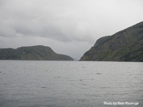
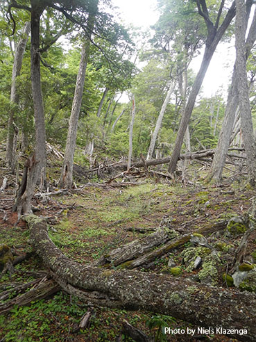
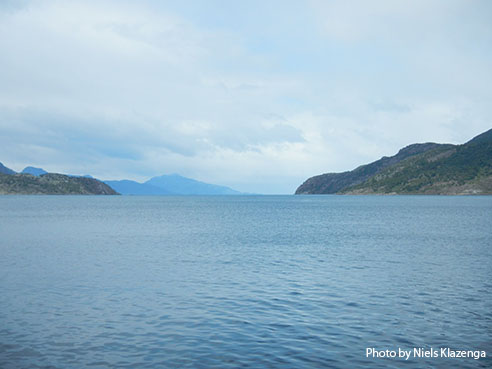 Once we pull into the Murray Canal between Hoste and Navarino the seas calm immediately and we soon arrive at Puerto Inútil, aka the Useless Port. Puerto Inútil received this unusual name due to its open mouth which faces the wind, and its considerable depth, over 150 feet deep. And yet we are able to anchor. The weather here is finally the weather I had warned everyone about–cold, windy, rainy–and I am finally happy to not be too warm in my rain gear as we head into the field. Half of us head to one side of the bay, the other half to the other and the two sites prove to be very different from one another.
Once we are all back on the ship, Juan makes a joke about hiding in the forest should we ever hear a helicopter, and I finally learn the whole situation with the navy. I had provided the captain with a tentative itinerary the day we left Punta Arenas with the understanding that we might modify it depending on sea and weather conditions, but I had not counted on the navy being involved.
 Puerto Inútil, where we are now, and Wulaia, just south of here, were on that list. Since I have been to both these places before I assumed there wouldn’t be any problem in visiting them. It turns out that the navy only granted us permission to come here, but not to go ashore. But, since there seems to be little enforcement and we’re still not entirely clear whether we’re doing anything wrong, I have decided to adopt a “don’t ask, don’t tell” policy in terms of our future sites.
At least we are clear about three of our future sites, the ones that caused all the trouble back in Puerto Williams; we are 100% clear that we are allowed to collect on Pictón, Nueva and Lennox islands though we must be very careful because at least parts of these islands were at one time land mined and I certainly have no intention of endangering our group. I address my concerns with the captain, and he assures me he understands the boundaries and where the mine-free areas are. I have complete faith in our captain, and his word is good enough for me.
After dinner the microscopes come out again. Yesterday was such a late day that Blanka and Laura were unable to look at the oil bodies from their Pico de la Bandera collections. Since we are anchored here for the night, they are able to get started earlier than usual. I hope it is just today, perhaps the weather, perhaps the specter of the navy, but everyone seems a little testy and short-tempered, myself included. I sure hope this isn’t a trend for the rest of the trip. But, at least I am aware of it and I intend to be better-natured tomorrow.
Ed. note: NYBG scientist and Mary Flagler Cary Curator of Botany, Bill Buck has just returned from his annual expedition to the islands off Cape Horn, the southernmost point in South America, to study mosses and lichens. For the past two years he was able to file stories from the field, but this year’s locations proved so remote he was forced to wait until his return. We will be publishing them over the course of several days. Follow his journeys on Plant Talk.
Bill Buck’s Previous Reports From the Field:
2013
January 10, 2013, Punta Arenas, Chile
2012
February 5, 2012; Isla Londonderry, Puerto Fortuna, approximately 54º54’S, 70º26’W
February 4, 2012; Isla O’Brien, Caleta Americana, approximately 54º53’S, 70º23’W
February 3, 2012; Isla Grande de Tierra del Fuego, Fiordo Garibaldi, approximately 54º58’S, 69º49’W
February 2, 2012; Isla Gordon, middle arm of Bahía Tres Brazos, approximately 54º58’S, 69º41’W
January 31, 2012; Isla Gordon, Bahía Romanche, 54º57’S, 69º30’W
January 30, 2012; Isla Gordon, Bahía Romanche, 54º57’S, 69º30’W
January 25, 2012; Isla Darwin, Caleta Virginia, approximately 54º57’S, 70º10’W
January 23, 2012; Arm of Estero Webb, SW coast of Isla Hoste, approximately 55º14’S, 69º41’W
January 22, 2012.; Unnamed sound on Isla Gordon behind Cabo El Gorro, approximately 55º02’S, 69º48’W
January 21, 2012; Isla Hoste, Estero Fouque, 55º1’S, 69º35’W
January 20, 2012; Isla Hoste, Estero Fouque, approximately 55º11’S, 69º35’W
January 18, 2012; Canal O’Brien, just south of Isla O’Brien, 54º55’S, 70º35’W
January 17, 2012; Punta Arenas, Chile
2011
July 15, 2011; Hobart, Tasmania, Australia
July 14, 2011; Pyengana, Tasmania, Australia
July 13, 2011; Weldborough, Tasmania, Australia
July 12, 2011; Hobart, Tasmania, Australia
July 11, 2011; Hobart, Tasmania, Australia
February 8, 2011; Punta Arenas, Chile
February 5, 2011, unnamed sound northwest of Isla Georgiana
February 4, 2011, unnamed sound directly east of Seno Mama, Chile
February 2, 2011, Seno Courtenay, northern arm, Chile
February 1, 2011, Seno Courtenay, Chile
January 31, 2011, Canal between Isla Georgiana and Isla Clementina,, Chile
January 30, 2011, Unnamed sound on south side of Brecknock Peninsula, NW of Isla Georgiana, Chile
January 29, 2011, Isla Aguirre, Seno Quo Vadis, Chile
January 26, 2011, Punta Arenas, Chile
January 24, 2011, Seno Chasco, just north of isthmus to Brecknock Peninsula, Chile
January 23, 2011, Isla Grande de la Tierra del Fuego, Puerto Consuelo, Seno Chasco, Chile
January 22, 2011, Isla Grande de la Tierra del Fuego, Seno Brujo, Chile
January 21, 2011, Isla Grande de la Tierra del Fuego, Seno Brujo, Chile
January 20, 2011, Isla Grande de la Tierra del Fuego, Seno Bluff, Chile
