From the Field: Bill Buck in Cape Horn 2013, Day 18
Posted in Bill Buck, From the Field, Science on March 14 2013, by William R. Buck
January 27, 2013, Prov. Antártica Chilena, Comuna Cabo de Hornos, Isla Navarino, Puerto Toro, 55°05’S, 67°04’W
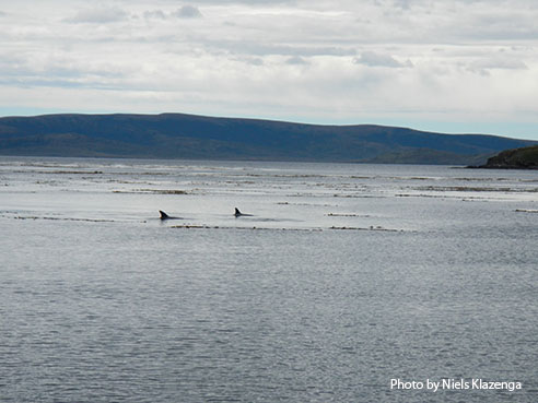
 This morning I am not alone in rising early. Today is our only opportunity to go into the field on Isla Lennox. It is so warm and sunny that it is hard to decide on an appropriate outfit, one that is not too heavy and yet still waterproof when sitting on the ground. The plan is to spread out so as to cover as much of this substantial island as possible, all the while avoiding landmines.
Laura and I decide to work our way along what appears to be a river, but is indicated as an inlet of the sea on our map. The tannic water flowing down into the sea seems to indicate that it is at the very least brackish. It is not rich in moss flora, at least where I am, but I do find a few species of Ulota. Last year one of our traveling companions was Ricardo Garilleti, who is working on this genus in southern South America. Not only is Ricardo a great traveling companion, but he taught me how to be a better collector of this most frequently-encountered genus of epiphytes in this region. Without his knowledge I never would have guessed that different species of Ulota prefer different substrate, especially in terms of Berberis versus Nothofagus.
 In addition to looking out for these Ulota species, I am also keeping my eye out for the gemmiferous Pottiaceae we found on Pictón and Nueva. Unfortunately, I am unsuccessful in finding it again. Despite the slim pickings, today is one of the most pleasant weather mornings I have seen in all my years down here.
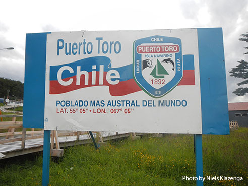
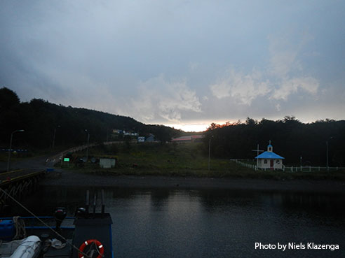
The captain requests that everyone return to the ship by 1 p.m. After Isla Lennox we make a three hour trip to Puerto Toro on the east coast of Navarino. Puerto Toro is the southernmost populated place in the world. Mind you, there are only 10 houses here and I understand only four are inhabited year round. However, there is a police station–but no military–and although the village is small, it is quite charming. The streets are unpaved and the sidewalks are wooden and elevated, presumably to get above the winter snow.
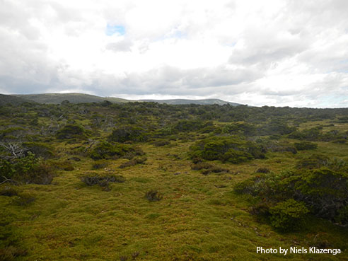
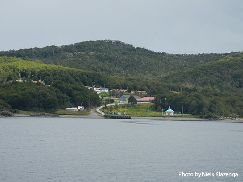 There is a substantial dock here so we do not have to use the Zodiacs to get ashore. Most of us walk toward a dam above the town, but I get distracted by a peatland shortly before the dam and never make it there. The peatland is rich in species of fly-dispersed Splachnaceae as well as a number of other interesting mosses, including the regional endemic genus Neomeesia. My collecting done, I walk back to the ship in order to get my wet specimens onto the dryer as quickly as possible. The Chileans are anxious to get back to the ship before 6 p.m. because despite the town’s small size, there is television reception and soccer to be watched! The game is an under-20 match between Chile and Uruguay. In the previous game, against Paraguay, Chile lost, causing much distress among some of the crew. Soccer is not a sport that I follow or am particularly interested in, but I do love how the game is about whether or not “we” win or lose, even though “we” have nothing to do with it.
 Earlier, as we pulled into Puerto Toro we learned that there is someone in town who sells cake. With Laura chanting “Torta! Torta! Torta!” the captain places an order over the radio. About 9:00 p.m., after we have finished dinner, the captain walks into town and returns a short time later with a large box. Inside is a large vanilla cake with layers of canned peach slices, dulce de leche, and milk chocolate frosting. We gather in the galley, scientists and crew alike, and promptly devour three-quarters of the cake. Once again a great morale booster so late in the trip, and well worth the $25 price tag.
 We’re down to the final few days of our trip and trying to squeeze a few more collecting sites into our limited time. Tomorrow I have decided that the ship will leave Puerto Toro at 6 a.m., arriving 45 minutes later at a small harbor on the opposite side of Isla Pictón from where we collected a few days ago. We will have three hours to collect here before heading back to Puerto Williams. The captain tells me we are 43 hours away from Punta Arenas, and that is without any stops. We need time in Puerto Williams to gather our specimens from the Universidad de Magallanes field station. We will spend one night there, leaving midday on January 29, probably making a second stop to pick up the aforementioned peatmoss samples. All too soon we will be back in Punta Arenas.
Ed. note: NYBG scientist and Mary Flagler Cary Curator of Botany, Bill Buck has just returned from his annual expedition to the islands off Cape Horn, the southernmost point in South America, to study mosses and lichens. For the past two years he was able to file stories from the field, but this year’s locations proved so remote he was forced to wait until his return. We will be publishing them over the course of several days. Follow his journeys on Plant Talk.
Bill Buck’s Previous Reports From the Field:
2013
January 10, 2013, Punta Arenas, Chile
2012
February 5, 2012; Isla Londonderry, Puerto Fortuna, approximately 54º54’S, 70º26’W
February 4, 2012; Isla O’Brien, Caleta Americana, approximately 54º53’S, 70º23’W
February 3, 2012; Isla Grande de Tierra del Fuego, Fiordo Garibaldi, approximately 54º58’S, 69º49’W
February 2, 2012; Isla Gordon, middle arm of Bahía Tres Brazos, approximately 54º58’S, 69º41’W
January 31, 2012; Isla Gordon, Bahía Romanche, 54º57’S, 69º30’W
January 30, 2012; Isla Gordon, Bahía Romanche, 54º57’S, 69º30’W
January 25, 2012; Isla Darwin, Caleta Virginia, approximately 54º57’S, 70º10’W
January 23, 2012; Arm of Estero Webb, SW coast of Isla Hoste, approximately 55º14’S, 69º41’W
January 22, 2012.; Unnamed sound on Isla Gordon behind Cabo El Gorro, approximately 55º02’S, 69º48’W
January 21, 2012; Isla Hoste, Estero Fouque, 55º1’S, 69º35’W
January 20, 2012; Isla Hoste, Estero Fouque, approximately 55º11’S, 69º35’W
January 18, 2012; Canal O’Brien, just south of Isla O’Brien, 54º55’S, 70º35’W
January 17, 2012; Punta Arenas, Chile
2011
July 15, 2011; Hobart, Tasmania, Australia
July 14, 2011; Pyengana, Tasmania, Australia
July 13, 2011; Weldborough, Tasmania, Australia
July 12, 2011; Hobart, Tasmania, Australia
July 11, 2011; Hobart, Tasmania, Australia
February 8, 2011; Punta Arenas, Chile
February 5, 2011, unnamed sound northwest of Isla Georgiana
February 4, 2011, unnamed sound directly east of Seno Mama, Chile
February 2, 2011, Seno Courtenay, northern arm, Chile
February 1, 2011, Seno Courtenay, Chile
January 31, 2011, Canal between Isla Georgiana and Isla Clementina,, Chile
January 30, 2011, Unnamed sound on south side of Brecknock Peninsula, NW of Isla Georgiana, Chile
January 29, 2011, Isla Aguirre, Seno Quo Vadis, Chile
January 26, 2011, Punta Arenas, Chile
January 24, 2011, Seno Chasco, just north of isthmus to Brecknock Peninsula, Chile
January 23, 2011, Isla Grande de la Tierra del Fuego, Puerto Consuelo, Seno Chasco, Chile
January 22, 2011, Isla Grande de la Tierra del Fuego, Seno Brujo, Chile
January 21, 2011, Isla Grande de la Tierra del Fuego, Seno Brujo, Chile
January 20, 2011, Isla Grande de la Tierra del Fuego, Seno Bluff, Chile
