From the Field: Bill Buck in Cape Horn 2013, Day 19
Posted in Bill Buck, From the Field, Science on March 15 2013, by William R. Buck
January 28, 2013, Prov. Antártica Chilena, Comuna Cabo de Hornos, Isla Navarino, Puerto Williams, 54°56’S, 67°37’W
 The engines start up again at 6 a.m. and quite soon we arrive at Caleta Piedras on Isla Pictón. We knew ahead of time that today would be an early day of collecting because we need to also get back to Puerto Williams to gather up the specimens we left behind there. What we didn’t know was that there would be a substantial metal dock at this site, and a house flying the Chilean flag, too. The house is empty now, but presumably occupied seasonally.
The harbor is appropriately named–piedra being Spanish for rock–because there are large outcrops very close to shore. We disperse ourselves across this landscape in an effort to cover as much ground and collect as many samples as we can. This is our second stop on Isla Pictón, and we are hoping that it will give us a better idea of the island’s bryoflora. Fortunately we are informed that this part of the island was never land mined. Even had it been, the physical evidence left behind by grazing cows makes me think that they would have triggered the land mines long ago.
 We have only 2 1/2 hours to collect here, and the low morning light makes the collecting difficult. In my hurry to get into the field I soon realize I do not have enough paper bags. When I run out of bags I return to the ship (which is made easy by the existence of the dock) and grab another handful of bags. With only a half an hour left to collect I concentrate my collecting to the shore. To my surprise, this is better collecting than on the rock outcrops in the forest, and what I find is certainly new to the island. I am once again let down to not find the Pottiaceae from the other side of the island. By 10:30 a.m. we are all back on the ship and underway to Puerto Williams.
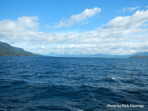
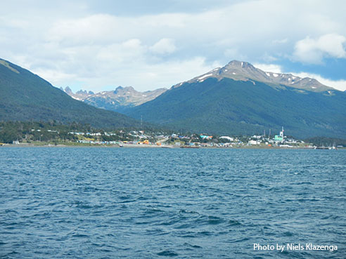
We arrive in Puerto Williams about 1 p.m. under very windy conditions. The port is actually closed due to the wind, which means that no boats may depart but that we are able to dock. However, we hope that the port will reopen by morning so that we may continue our journey toward Punta Arenas. By night, under a bright, almost-full moon, the winds subside and we begin to feel confident that we will be able to leave as scheduled in the morning.
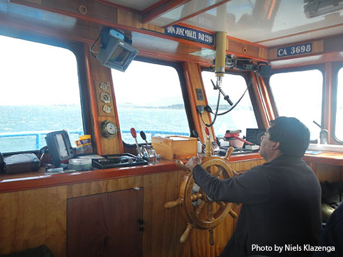
 When we were last in Puerto Williams we met a couple who had been living on their sailboat for 22 years, and had recently been chartering it out for scientific trips. We had hoped at the time to meet up with them to see their boat, and to show them around the Miguel, but time did not allow for it. This time though, we are able to. Turns out, I’m really glad we’re on the ship we’re on! The sailboat would never be large enough for our group and equipment. Our collections would quickly fill up the smaller space on the sailboat, and there would be little room for our microscopes. However, they are considering purchasing a larger ship in order to expand their scientific expeditions, and so we agree to keep in touch.
And just like that, we’re down to our last two days in the field, and most of that will be occupied with our transit back to Punta Arenas.
Ed. note: NYBG scientist and Mary Flagler Cary Curator of Botany, Bill Buck has just returned from his annual expedition to the islands off Cape Horn, the southernmost point in South America, to study mosses and lichens. For the past two years he was able to file stories from the field, but this year’s locations proved so remote he was forced to wait until his return. We will be publishing them over the course of several days. Follow his journeys on Plant Talk.
Bill Buck’s Previous Reports From the Field:
2013
January 10, 2013, Punta Arenas, Chile
2012
February 5, 2012; Isla Londonderry, Puerto Fortuna, approximately 54º54’S, 70º26’W
February 4, 2012; Isla O’Brien, Caleta Americana, approximately 54º53’S, 70º23’W
February 3, 2012; Isla Grande de Tierra del Fuego, Fiordo Garibaldi, approximately 54º58’S, 69º49’W
February 2, 2012; Isla Gordon, middle arm of Bahía Tres Brazos, approximately 54º58’S, 69º41’W
January 31, 2012; Isla Gordon, Bahía Romanche, 54º57’S, 69º30’W
January 30, 2012; Isla Gordon, Bahía Romanche, 54º57’S, 69º30’W
January 25, 2012; Isla Darwin, Caleta Virginia, approximately 54º57’S, 70º10’W
January 23, 2012; Arm of Estero Webb, SW coast of Isla Hoste, approximately 55º14’S, 69º41’W
January 22, 2012.; Unnamed sound on Isla Gordon behind Cabo El Gorro, approximately 55º02’S, 69º48’W
January 21, 2012; Isla Hoste, Estero Fouque, 55º1’S, 69º35’W
January 20, 2012; Isla Hoste, Estero Fouque, approximately 55º11’S, 69º35’W
January 18, 2012; Canal O’Brien, just south of Isla O’Brien, 54º55’S, 70º35’W
January 17, 2012; Punta Arenas, Chile
2011
July 15, 2011; Hobart, Tasmania, Australia
July 14, 2011; Pyengana, Tasmania, Australia
July 13, 2011; Weldborough, Tasmania, Australia
July 12, 2011; Hobart, Tasmania, Australia
July 11, 2011; Hobart, Tasmania, Australia
February 8, 2011; Punta Arenas, Chile
February 5, 2011, unnamed sound northwest of Isla Georgiana
February 4, 2011, unnamed sound directly east of Seno Mama, Chile
February 2, 2011, Seno Courtenay, northern arm, Chile
February 1, 2011, Seno Courtenay, Chile
January 31, 2011, Canal between Isla Georgiana and Isla Clementina,, Chile
January 30, 2011, Unnamed sound on south side of Brecknock Peninsula, NW of Isla Georgiana, Chile
January 29, 2011, Isla Aguirre, Seno Quo Vadis, Chile
January 26, 2011, Punta Arenas, Chile
January 24, 2011, Seno Chasco, just north of isthmus to Brecknock Peninsula, Chile
January 23, 2011, Isla Grande de la Tierra del Fuego, Puerto Consuelo, Seno Chasco, Chile
January 22, 2011, Isla Grande de la Tierra del Fuego, Seno Brujo, Chile
January 21, 2011, Isla Grande de la Tierra del Fuego, Seno Brujo, Chile
January 20, 2011, Isla Grande de la Tierra del Fuego, Seno Bluff, Chile
